 |
The only portrait of
Daniel Boone, painted from life, by Chester Harding in June 18201
|
Daniel Boone once
famously said that “I have never been
lost, but I was once bewildered for three days” 2. The distinction between “lost” and “bewildered”,
that Daniel Boone made is a very interesting distinction, and it deserves to be
explored. How was he able to be “bewildered” for three days without
becoming “lost”? What is the difference between “bewildered” and “lost”? Finally, what should
modern 18th century reenactors and wilderness adventurers do to
avoid becoming “bewildered”, or becoming
“lost”?
 |
Gentlemen’s Lexicon, or a
Pocket Dictionary, 1835
|
The word “bewildered” in the late 18th
and early 19th centuries had a different meaning then than it does
today. Then it meant confused, lead
astray or turned around in the wilderness in a manner, that is similar to what today
we would call disoriented, the first step towards Woods shock.
 |
The Five Stages of “Woods
Shock”, drawn by the author.
|
“Disorientation” is the springboard
into the five stages of Woods shock and becoming “lost” (for more on Woods Shock, please see “Getting Lost And What
To Do About It”, Circa 1915”, HERE). Woods
shock is the term that describes the fear that can overcome people when they lose
spatial orientation and become disoriented in the wilderness. A loss of spatial orientation occurs when the
physical world around us, no longer matches our preconceived notions and our mental
model of the world. This mismatch
between the physical world around us and our mental model begins in the
“disorientation” stage and leaps with us into the five stages of woods shock.
In the “disorientation”
stage of Wood shock, people will begin to realize that they are confused and
uncertain of where they are. If you
become disoriented, you can either, give into your fears, or you can S.T.O.P.,
take a couple of deep breaths, and keep your head.
If you can keep your
head, then you will be merely disoriented and “bewildered” or as I like to say “misplaced”. By not giving
into your fears, you are able to take positive steps to aid in your survival,
like re-orienting yourself, building a shelter, gathering wood and lighting a fire,
or drinking some water or eating something.
If, on the other hand, you give into your fears and begin to “bend
the map”, frantically searching for any landmark that matches your mental map, trying
to force the real world around you to correspond to your failed mental map, until
you are hopelessly confused; you will be “lost”. Bending the map results in the frantic hope
that you will find a known landmark just around the bend of the trail or over
the next ridge. Once you have given into
your fears and have bent the map, it gets harder and harder to unbend it and you
will get more and more confused and panicky, until you are finally forced to
admit that you do not know where you are.
Once a disoriented person panics, they are “lost” and will not be able to take any positive steps to aid in
their survival and they have a very good chance of being found dead, by their
rescuers, due to exhaustion, dehydration, hypothermia, anxiety, injury or even
hunger.
When Daniel Boone spoke
of being “bewildered for three days”,
it is obvious, that he did not give in to his fears and instead he took
positive steps to insure his survival, while he reoriented himself, and that
was why he was merely “bewildered”
and not “lost”.
Okay you say, Daniel
Boone was one of history’s greatest woodsmen, what about us mere mortals, what
can we do to keep from becoming “bewildered”
and then “lost”?
First, before you head
out into the wilderness, get a map and study it. Study your map and then study it again, until
you can see it in your mind. During the
late 18th and early 19th centuries, when Daniel Boone was
exploring the Middle Ground, if you had a map it wouldn’t have had much detail
and many of the details it did have, were wrong: many parts of the map were
simply blank.
 |
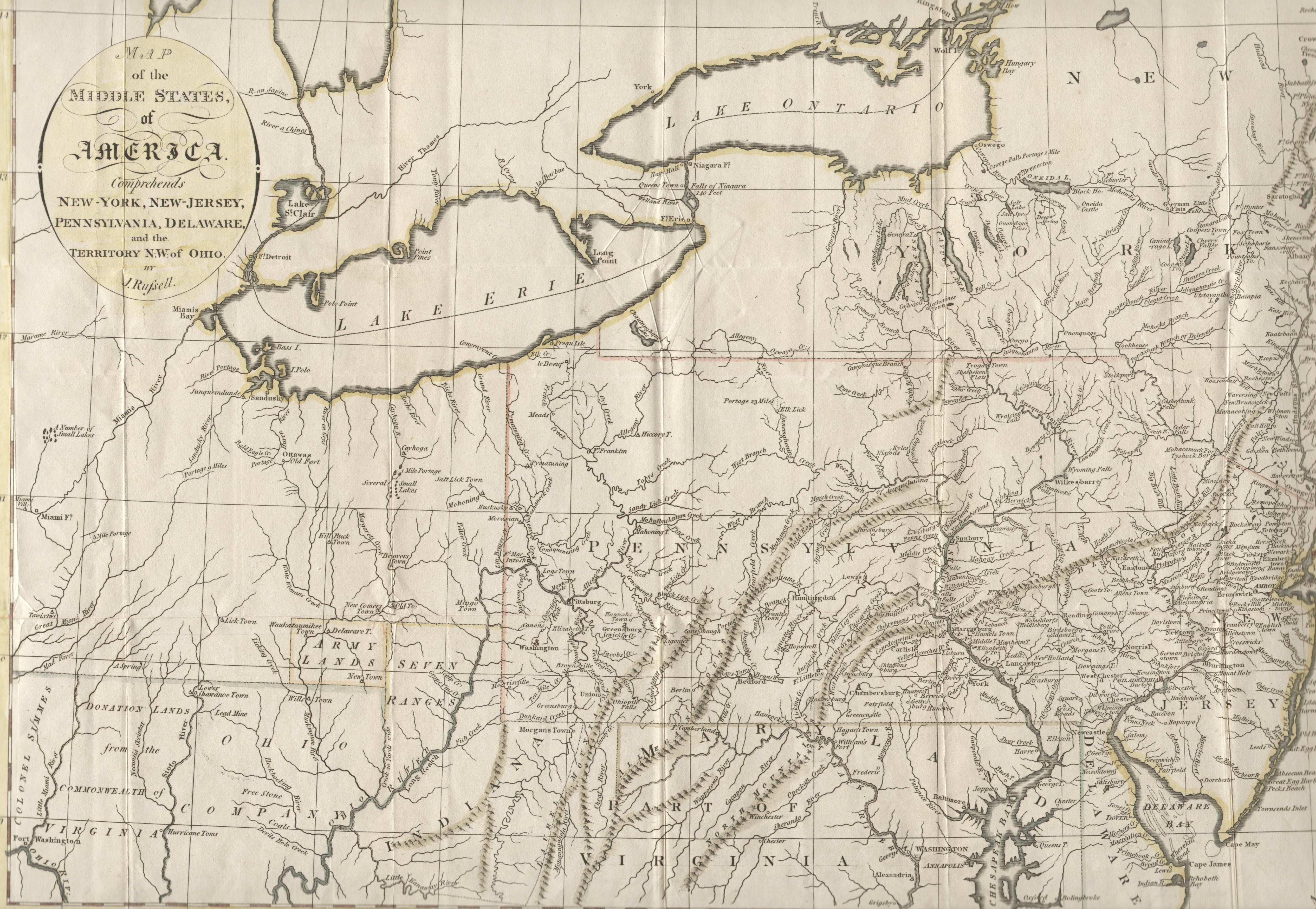
“A Map Of The Middle
States, Of America”, by J. Russell, 1794.
Note the blank area, which covers all of Western New York State, at
that point in America’s history it hadn’t been mapped yet. From www.mapsofpa.com
|
Today’s 18th
century reenactors and wilderness adventurers are blessed with an excess of
very accurate maps, however that doesn’t mean that it is easy to match the
terrain you see, to what is shown on the map.
Many times what you see doesn’t look anything like the map, due to high
or low water levels, blow-downs, etc.; so before you enter the wilderness,
study satellite photos. This will help
to prevent “bending the map” because if you know what the area looks like from
above, you will be able to match the world you see around you, to what you see
on your map.
 |
| Ragged lake, Algonquin Provincial Park, from Jeff’s Map, Algonquin Provincial Park |
 |
Ragged lake, Algonquin
Provincial Park, from Map data: Google, DigitalGlobe @ 2019
|
 |
A close-up of Ragged
lake, Algonquin Provincial Park, it doesn’t look anything like the map. From Map data: Google, DigitalGlobe @ 2019
|
 |
A close-up of Archer Bay,
Ragged lake, Algonquin Provincial Park, it doesn’t look anything like the
map. From Map data: Google, DigitalGlobe
@ 2019
|
A case in point would be
2017, when I canoed through Ragged Lake to South Bay looking for the portage
into the next lake, I had a great deal difficulty matching what I saw from the
canoe to the map I was holding and I became disoriented. I had to take a couple of deep breaths and
consult with my wife, who was steering the other canoe, before we were able to
find the portage.
Neither Archer Bay or
South Bay look at all like they do on Jeff’s Map, as you can see from the
satellite photos of Ragged Lake, and in particular the close-ups of both Archer
Bay and South Bay. The map of South Bay
seemed to show open water, when what we saw was thick marsh. This was compounded by the fact that we had
been looking for Archer Bay, to use it as a landmark. From the map, we expected Archer Bay to be an
open bay, with an island in the center, when in fact what we saw was a marsh, blocked
by a tree-covered sandbar and completely choked with vegetation. When I got back to civilization and looked at
Google Maps’ satellite photos, I decided that from then on, I would always
study satellite photos before I leave for a wilderness adventure. If I had thought to look at satellite photos
before my trip, I would have known what to expect when I passed Archer Bay on
my way to South Bay and the portage. These
days, because of the internet, modern woodsman can easily view birds eye,
satellite pictures of the terrain they will be exploring, something that was
unavailable to the late 18th and early 19th centuries
explorers, or to anyone, quite frankly, until very recently: so look up
satellite photos of the area that you will be exploring, before you go.
Chester Harding, the
artist who painted the only portrait of Daniel Boone from life, in June 1820,
noted that Daniel Boone never carried a compass with him on his long hunts. However, just because Daniel Boone didn’t
carry a compass, and most likely didn’t carry a map, with him on his trips into
the wilderness, doesn’t mean that today’s 18th century reenactors
and wilderness adventurers shouldn’t carry both a map and a compass. As a matter of fact, it is a good idea to
always carry two compasses, since one can get broken and more importantly, if you
are disoriented and begin to panic, you might not believe a single compass, but
you will believe two, when they are both pointing the same way.
While you are exploring
the wilderness, always look behind you at your back trail, as this will make it
easier to recognize landmarks you have passed, if you have to reorient yourself
and travel back out.
Most importantly, if you
do become disoriented, and if you spend any time in the wilderness you will,
remember that it is okay; even Daniel Boone was “bewildered for three days”.
Just stop and sit down, think, organize and plan and whatever you do, do
not “bend the map’ and panic, because if you do you will be truly “lost”.
I hope that you continue
to enjoy The Woodsman’s Journal Online and my videos at BandanaMan Productions
and don’t forget to follow me on both The Woodsman’s Journal Online and
subscribe to BandanaMan Productions on YouTube, and if you have questions, as
always, feel free to leave a comment on either site.
Notes
1 Wikimedia, “Unfinished Portrait of Daniel
Boone”
2 Margaret E. White, Editor, A Sketch of
Chester Harding, Artist: Drawn By His Own Hand, p. 48
3 Ibid, p. 48
Sources
Gentlemen’s Lexicon; or a
Pocket Dictionary [John Grigg, Philadelphia, PA, 1835] p. 40 https://books.google.com/books?id=bqEVAAAAYAAJ&pg=PA40&dq=%22bewildered%22+lexicon+dictionary&hl=en&sa=X&ved=0ahUKEwiC94-LrtbdAhVPc98KHYO3BRMQ6AEIPjAE#v=onepage&q=%22bewildered%22%20lexicon%20dictionary&f=false,
accessed 9/21/18
Jeff’s Map, Algonquin
Provincial Park, http://www.algonquinmap.com/,
accessed 6/25/19
Map data: Google,
DigitalGlobe @ 2019
“A Map Of The Middle
States, Of America”, by J. Russell, 1794 http://www.mapsofpa.com/18thcentury/1794russell.jpg, accessed 6/9/19
Margaret E. White, Editor, A Sketch of Chester Harding, Artist: Drawn By
His Own Hand, (Houghton, Mifflin and Company, New York [1890]) p 47-48
reprinted in https://books.google.com/books?id=zgROAAAAMAAJ&pg=PA48&lpg=PA48&dq=%22he+had+a+very+large+progeny%22+%22chester+harding%22&source=bl&ots=I9y_v-yRI2&sig=qxwqKUR9y42naWBjhoArGJi2P5U&hl=en&sa=X&ved=2ahUKEwj4goGi7czdAhXEnOAKHWvECaoQ6AEwAHoECAUQAQ#v=onepage&q=%22he%20had%20a%20very%20large%20progeny%22%20%22chester%20harding%22&f=false,
(accessed 9/21/2018)
Wikimedia, “Unfinished Portrait of Daniel Boone”, https://upload.wikimedia.org/wikipedia/commons/7/79/Unfinished_portrait_of_Daniel_Boone_by_Chester_Harding_1820.jpg,
(accessed 9/21/2018)
No comments:
Post a Comment