

Imagine it is in the middle of winter of some
year between 1794 and 1814, the exact year doesn’t really matter. You’ve walked all day, become turned around, bewildered
even, in a giant frozen swamp, on the edge of the American Old Northwest
Frontier. It’s bitterly cold, and the
Sun is going down. It will be dark soon,
and it’s going to get colder, much colder.
Can you do better than the Lost
Traveller did? He survived to tell the tale,
would you?


A massive, impassable wetland stretching
across the northern parts of Genesee and Orleans counties, in New York state, which
included within it today, the towns of Alabama, Oakfield, Elba, Barre, and
Clarendon. It measured roughly 15 to 20
miles long and several miles wide. The
swamp was a major geographic barrier during the early 1800s and was covered
with thick, wet woods, deep mud, and dense vegetation, making it nearly
impossible to cross or farm. Early
pioneer records note the swamp was home to dangerous wildlife, including large
populations of wolves. Being lost here,
especially in the winter, was no joke. So
what did the ‘Lost Traveller’ do wrong; and what did he do right...let’s find
out.

What he did wrong...


Our
‘Lost Traveller’ and his companion entered the wilderness without a compass, means
of creating fire, food or any spare clothing, because they assumed they couldn’t
possibly get lost. If they had
remembered to bring a compass and knew that their path would generally be to
the west to north-west, then perhaps they wouldn’t have lost their way.

Even
without a compass, if they had only known that in the winter, near the
solstice, on December 21, six days after they set out, the sun rises in the
southeast (30° to 32° south of due east, actually), before crossing through the
southern hemisphere, and then setting in the southwest (30° to 32° south of due
west), perhaps they would have been able to find their way from the twin
villages of Hartford and Canawagus, New York, which today are known as Avon,
New York, to the Niagara Falls area without a problem.


As
it was, they were bewildered, not yet lost, but without any food, or extra dry
clothes which was their baggage; as the temperatures plummeted, becoming bewildered
was truly becoming an emergency.
So,
now we know what the ‘Lost Traveller’ did wrong. To recap, here is what he should have done.

Before
heading into the wilderness always carry a compass. Even if you or your guide know how to get
from point A to point B, carry a compass for emergencies. Constantly check your compass to make sure
you are still on track.


If
you manage to go off trail, follow your foot-steps and back track to where you
know where you are, DON’T wander and try a shortcut. Like a free lunch, there is no such thing as
a shortcut.


But what did he do right? To find out, tune in next week and read “Lost
in Late 18th and Early 19th centuries...Lessons Learned, What he did right©

For more on the ‘Lost
Travellers’ tale of survival read “Lost in the Great Tonewanta Swamp, 1796!
Part One©, HERE.
I hope that you enjoy
learning from this resource! To help me
to continue to provide valuable free content, please consider showing your
appreciation by leaving a donation HERE.
Thank you and Happy Trails!
I
hope that you continue to enjoy The Woodsman’s Journal Online and look for me
on YouTube at BandanaMan Productions for other related videos, HERE. Don’t forget to follow me on both The
Woodsman’s Journal Online, HERE,
and subscribe to BandanaMan Productions on YouTube. If you have questions, as always, feel free
to leave a comment on either site. I
announce new articles on Facebook at Eric Reynolds, on Instagram at
bandanamanaproductions, and on VK at Eric Reynolds, so watch for me.
That
is all for now, and as always, until next time, Happy Trails!
Sources
Beard Adelia Belle;
“Woodcraft for Outdoor Boys and Girls”, The Washington Reporter, February
11, 1920, page 5, https://books.google.com/books?id=SjFeAAAAIBAJ&pg=PA5&dq=%22without+maTCHES%22+1920&article_id=6504,6160930&hl=en&sa=X&ved=2ahUKEwjo5feX6aeVAxXYDHkGHYfXELsQ6AF6BAgJEAM#v=onepage&q=%22without%20maTCHES%22%201920&f=false,
accessed June 27, 2026
Department
of the Army, Basic Cold Weather Manual, FM 31-70, April 12, 1968,
[Paladin Press, Boulder, CO, 1974], page 61
Mackenzie, Eneas; An
Historical, Topographical, and Descriptive View of the United States of
America, [Mackenzie and Dent, London, 1819], page 508, https://books.googleusercontent.com/books/content?req=AKW5Qace32RK0rSk2jqxttZuRyh11-RXIcfKDUiiKI2LqpGDtENvzLmzCCnEHG_Ev8nqEVAcPJyp6APwbtdoTd0QhajdZzGAE-3hJKED9cWKNaBzt0wWnJfE80g4l-VQ6o46l1Sm1L9ZVjX7lZOeTTYPR42JEQXYLiWNzRTG-qafk12l5BpfurWXv4XYcwwoY4bcwF1loxkLYwYF8IJeFKS9FJy8JZNpop9CVwTynkDnYf5iEp4r4L8MgcBpeL6BFU4cbGfm7YaWVeL2upttQe2jNeXvAJCtHnn6YrwU1sPccngWgj9rYqI,
accessed July 11, 2026
Moses,
Thomas; “The Lost Traveller”, The Analectic Magazine, Volume 4,
[published by Moses Thomas, Philadelphia, PA; 1814], page 158, https://www.google.com/books/edition/The_Analectic_Magazine/pu84AQAAMAAJ?hl=en&gbpv=1&dq=%22the+lost+Traveller%22+analectic+magazine+1814&pg=PP13&printsec=frontcover,
accessed June 27, 2026
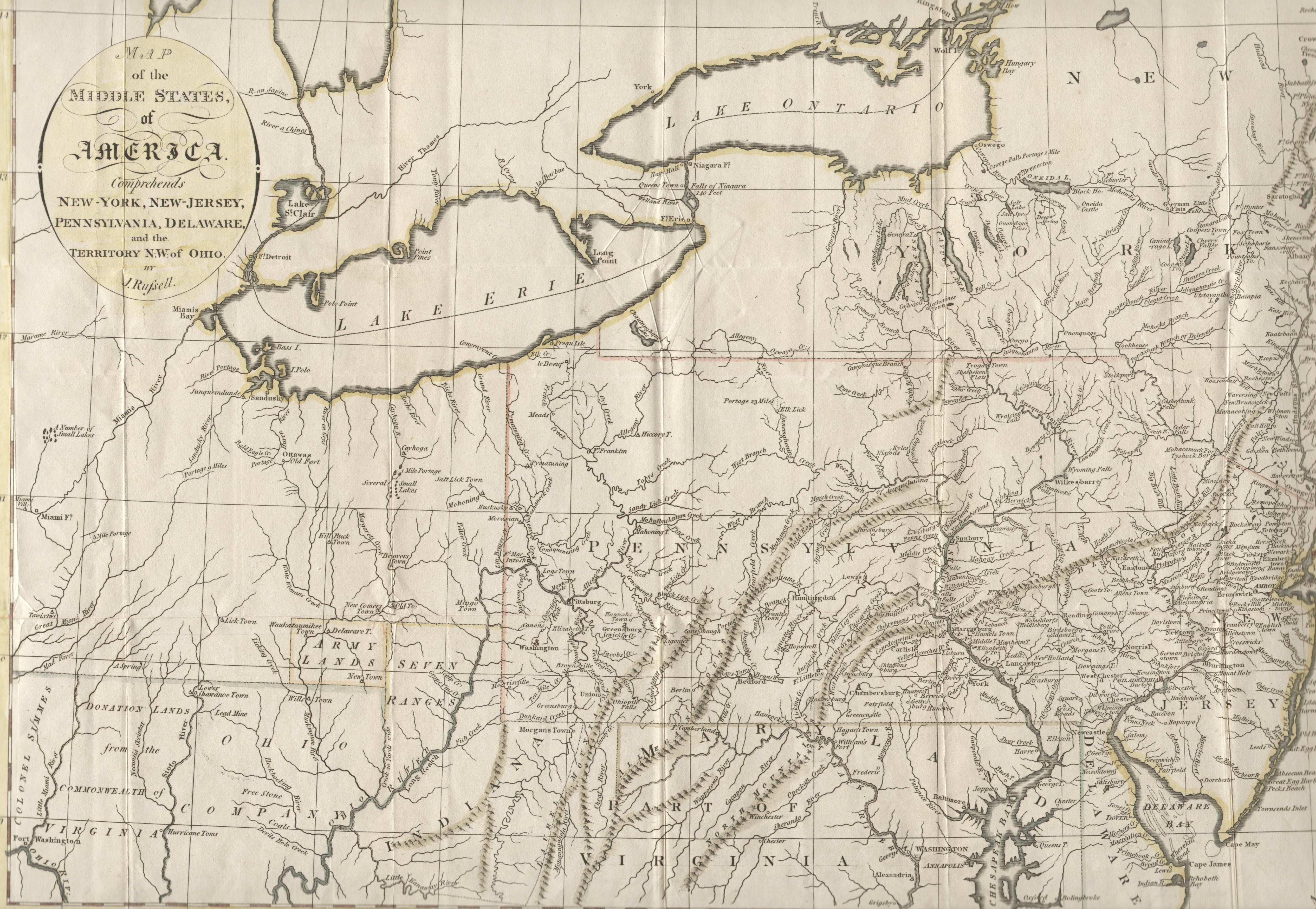
Russell, J.; “A Map Of
The Middle States, Of America”, 1794 http://www.mapsofpa.com/18thcentury/1794russell.jpg, accessed June 27, 2026
Sharp, Hal; “Sportsman’s
Digest: Start a Fire with Flint and Steel”, The News-Dispatch, September
18, 1972, page 5, https://books.google.com/books?id=02BVAAAAIBAJ&pg=PA5&dq=%22start+a+fire+with+flint+and+steel%22+1972&article_id=3452,5991692&hl=en&sa=X&ved=2ahUKEwjvnvTg7qeVAxUvpIkEHfdCPU8Q6AF6BAgIEAM#v=onepage&q=%22start%20a%20fire%20with%20flint%20and%20steel%22%201972&f=false,
accessed June 27, 2026
The
American Mountain Men; “Flint and Steel Steel Char Flint”, https://americanmountainmen.org/wp-content/uploads/2019/09/TLR-FIRE-2019-APRIL-28.pdf,
accessed June 27, 2026
Wikimedia,
“1821 A new map and profile of the proposed canal from Lake Erie to Hudson
River in the State of New York”, from the New York Public Library, 1821, https://commons.wikimedia.org/wiki/File:1821_A_new_map_and_profile_of_the_proposed_canal_from_Lake_Erie_to_Hudson_River_in_the_State_of_New_York,_from_the_New_York_Public_Library_-_510d47da-f059-a3d9-e040-e00a18064a99.jpg,
accessed July 11, 2026
Wikimedia,
“Glacial Lake Tonawanda, showing the movement of Niagara Falls”, By Matthew
Trump, May 1, 2004, https://commons.wikimedia.org/wiki/File:Wpdms_usgs_photo_lake_tonawanda.jpg,
accessed July 11, 2026



No comments:
Post a Comment